Cluverius, Philippus. NTRODUCTIONIS IN UNIVERSAM GEOGRAPHIAM. Navigation Page
|
|
|
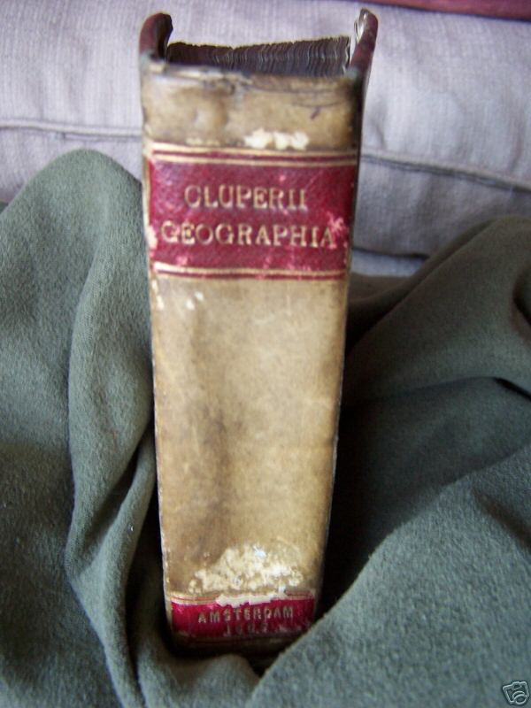
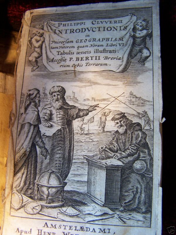
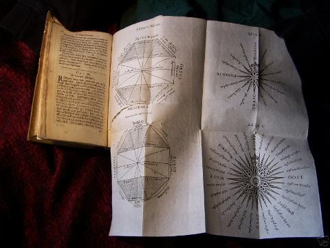
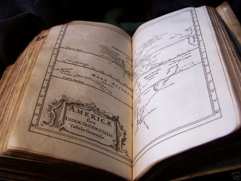
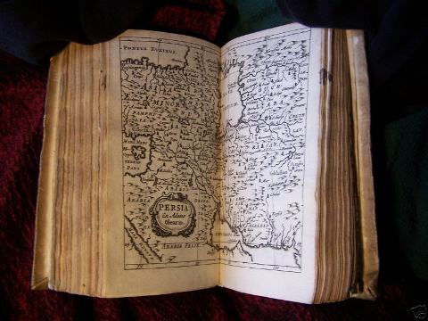
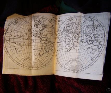
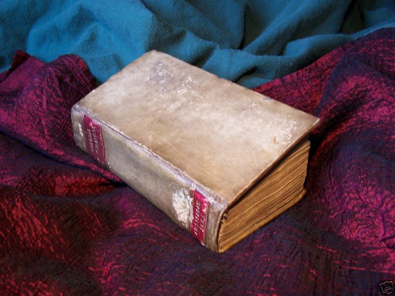
Philippus Cluverius’s (Phillip Cluver’s) “INTRODUCTION TO UNIVERSAL GEOGRAPHY”, INTRODUCTIONIS IN UNIVERSAM GEOGRAPHIAM, AMSTERDAM 1685, CLUPERII GEOGRAPHIA, tamveterem quam Noram Libri VI Tabulis aeneis illustrate. Accessit P. BERTII Brevia rium Orbis Terrarum., Amsterdam, Apud(at the shop of) Henr. Wetstenium, 1686. PHIL. CLUVERII. , Trigesimo-segundo 3 ¼ x 5 ½” tall, 355 pages + index 40 maps and tables. Full calf leather, Morroco red trim gilt in gold line. Lettering "CLUPERII GEOGRAPHIA"- AMSTERDAM 1685 on spine. Covers and spine are intact but unhinged from text of book, cover is only held by one piece of cloth on the bottom. . The book has a complete text , and all its maps. However it is missing four blanks in the front. Covers and spine have minor soiling and wear due to age. Important maps such as the Orbis Terrarum that shows California as an island (see photos), and the other showing California being a peninsula (Mexico) are present, not to mention the much sought after map of ( Crete together with ) Cyprus. Below is a list of the maps as they appear in the book. The text is written in Latin as well as the descriptions on the maps. There is some underlining in light pencil on several pages. There is a binders gathering between pages 4 and 5. The 8 ¾” x 8 ¾” fold out (see photo) has a tear, but the tear is not in the image. As a rule the more visible a tear is IN the image the greater the problem. This type of tear is common due to the fold out. The other maps are listed, and shown as photo space allows. They are in good shape. The Asia map is intact but is connected to the map attachment by ½”. That is the only loose map.Library seals from The Oriential Consistory Chicago, IL. On 2 pages. The Atlas on page 263-264 has an area out of page by the edge ,but not affecting the text. The Atlas inside is in very good condition for its age.This is a list of the tables, and illustrations: MAPS&TABLES 43 TOTAL 1.) TITLE FRONT PIECE COPPER ENGRAVING TITLE OF ATLAS 2.) Tables – pages 14-17 3.) Fold out Tropics and Equators(note tear in middle of diagram- see photo) 4.) Typus Inrervailorum variorum gentium 5.) Large fold out (see photo) Orbis Terrarum Typus 6.) Europa 7.) Typus Hispaniae Veteris 8.) Galliae Veteris Descriptio 9.) Germanie Cisrhenane 10.) Helvetiae 11.) Inferioris Germaniae Descriptio 12.) Britannica Rum Insula Rum Typus 13.) Germanie 14.) Sueviae 15.) Vindeliciae et Norici 16.) Nova Totius Germaniae Descriptio 17.) Dania Svecia et Norvegia 18.) Italia 19.) Ligures Taurini ect 20.) Histri Carni Veneti item Rhaetiae Pars. 21.) Etruria Latium Umbria 22.) Picentes, Vestini, Campania, Apulia, Lucania, Brutii ect. 23.) Italie Recentioris description 24.) Siciliae 25.) Corsicae Antiquae Tabula (single page) 26.) Sardinia Antiquae Tabula (single page) 27.) Graecie 28-29.) Creta Cyprus et Rhodes, Cyprus (Top and bottom double page see photo. Small box map with Rhodus. 30.) Thraciae 31.) Moesiae et Daciae Tabula Contineus Una POLO: Niam, Russian nigram ect. 32.) Russia 33.) Asia 34.) Imperii Sinarum Nova Descriptio 35.) India Vetus 36.) India Orientalis Nova 37.) Persia ex Adamo Olerio 38.) Armenia, Syria, Mesopotamia 39.) Natiolia, quae olim Asia Minor 40.) Palaestina et Phoenice 41.) Africa 42.) Aegyptus 43.) Americae Indiae Occidentalis Tabula generalis This is a list of the tables and maps. Most maps are DOUBLE page, there are two single page maps, and the fold out maps as noted. Over all inside pages are in good condition, maps are in very good condition. A great copy that is in good shape. An important historical addition to your library. While some of the world’s most prestigious libraries own copies of this scare edition-very rarely does one surface to the public market.
Price on request

|
|
|
|
|
|