|
|
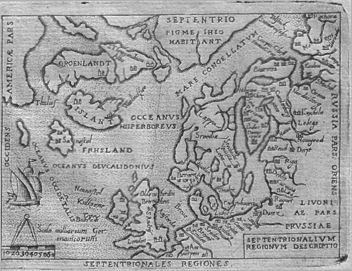
| Septentrionalium Regionum Descriptio. The map covers a wide area with the eastern shores of Canada in the west, then Greenland and Iceland with Russia in the east. The British Isles, Germany and north Poland in the south. Compass scale and a sailing ship in the North Atlantic. Price $ 220.00 |