Price: CyP 125.00 Framed
|
|
|
|
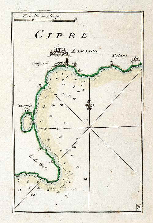
Cipre. By Roux,J.
Marseille, 1764.13 x 19.7 cms. Sea chart on heavy paper with sharp
impression. Coloured. Charming chart of Limassol harbour in the island
of Cyprus. Showing town and harbour plan, with soundings, anchorages,
rocks, shoals, fortifications and lighthouses. Cape Gata and the Salt
Lake. Price: CyP 125.00 Framed |
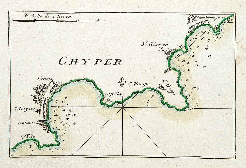
Chyper. By Roux,J. Marseille, 1764.13 x 19.7 cms. Sea chart on heavy paper with sharp impression. Coloured. Charming chart of the coast from Famagusta till Larnaca in the island of Cyprus. Showing town and harbour plan, with soundings, anchorages, rocks, shoals, fortifications and lighthouses. Price: CyP 115.00 Framed |
Pages 1 2 3 4 5 6 7 8 9 10 11 12 13 14 15 16 17 18 19 20 21 22 23 24 25 26 27 28 29 30 31 32 33 34 35 36 37 38 39 40 41 42 43 44