
|
|
|
|
|
|
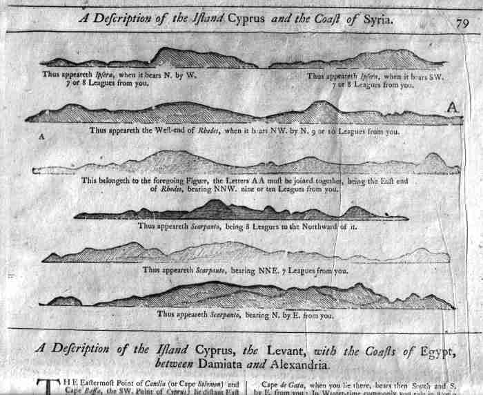
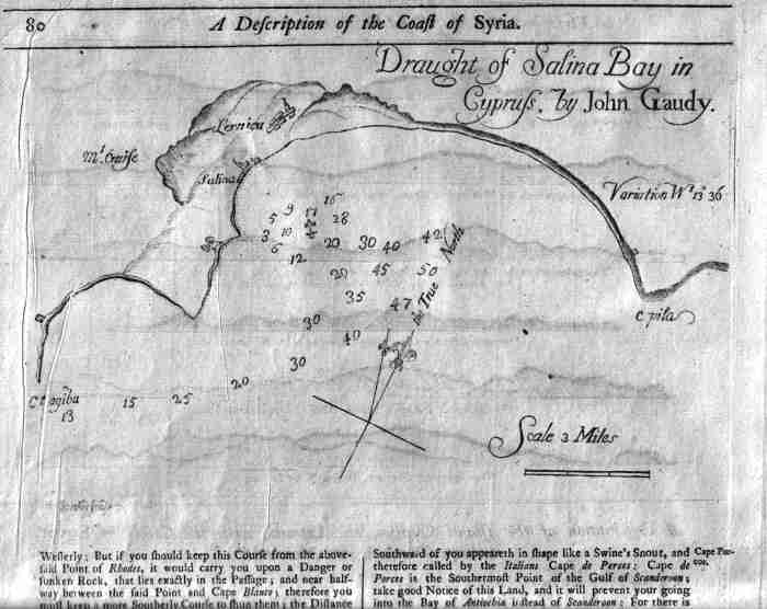
| Draught in Salina Bay in Cyprus by John Gaudy. 1730 or much earlier. Size of full page 30x47.5 cms. Size of this navigational chart is 23.5x15.5 cms. From John Seller's ' The English Pilot' . A Description of the Island of Cyprus, the Levant, with the Coasts of Egypt, between Damatia and Alexandria on recto and sketches (23.5x15.5 cms.) of the approaches to the Islands of Psara, Rhodes and Carpathos above text. Detailed accounts of the approaches to Cyprus from Cape Paphos, Gata, through to Cape Apostolos Andreas. Price: CyP 275.00 Framed | |
Pages 1 2 3 4 5 6 7 8 9 10 11 12 13 14 15 16 17 18 19 20 21 22 23 24 25 26 27 28 29 30 31 32 33 34 35 36 37 38 39 40 41 42 43 44