|
|
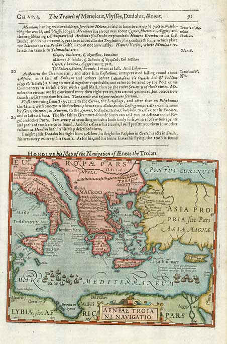
| Aeneae Troiani Navigatio. Samuel Purchas & Jodocus Hondius. London / 1625. Hand Coloured. 20x15 cms. Interesting regional map, illustrating the ships of Troy in the Mediterranean. From the 1625-26 edition of Purchas His Pilgrims, one of the seminal early 17th Century English Language travel works. On a 32x22 cms. sheet with English text, front and back. Price: CyP 135.00 |