Price: CyP 1100.00
Maps. Cyprus. Page 137.
|
|
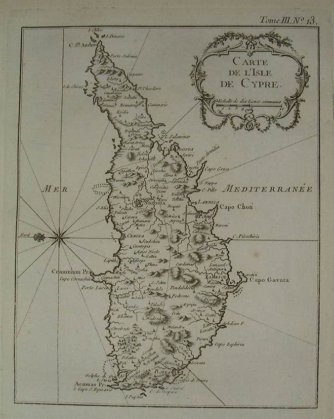
| Carte de L' Isle de Cypre
by Jacques Nicolas Bellin and is from his superb and rare atlas "Le
Petit Atlas Maritime" published in Paris, 1764.The map measures 24 cm
x 33 cms. This is an original antique map of Cyprus which is orientated
with the east pointing to the north and is printed on one side only.
The map is printed on good quality thick paper.
(Jacques Nicolas Bellin 1703-72. Bellin spent over fifty years at the
French Hydrographic Service where he was appointed the first 'Ingenieur
hydrographe de La Marine'. During his term of office there he was
commissioned to carry out major surveys, first of the coasts of France
and later of all the known coasts of the world. These tremendous
undertakings resulted in the production of a very large number of sea
charts of the highest quality which appeared in many editions with
varying numbers of charts to the end of the century. He was appointed 'Hydrographer
to the King' and was a member of the Royal Society in London. ) Price: CyP 1100.00 |
Page 131 132 133 134 135 136 137 138 109 140 141 142 143 144 145 146 147 148 149 150 151 152 153 154 155 156 157 158 159 160