Maps. Cyprus. Page 62
|
|
|
|
|
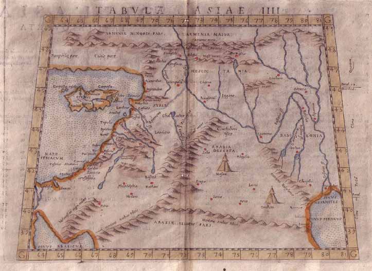
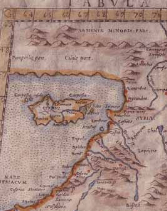
'Tabula Asiae IIII' by Ruscelli, 1562 is one of Ptolemy's originals. Places marked include Mesopotamia, Armenia, Arabia Deserta, Syria, Babylonia and Cyprus, cities include Babylon, Jerosolyma, Sidon, Damascus and Petra. There is good detail to rivers and mountains and two illustrations of tents. The map measures 9.5" by 7" with a centrefold (as issued), has later outline hand coloring, and is in good condition with some very small wormholes, and some marking/browning of the page. Claudius Ptolemy, an Alexandrine Greek, is probably the greatest of all early geographers. Working out of Alexandria in the first century AD he wrote a geography that was only published in Europe in the mid 1400's. His work provided the first real printed maps and he was held in such high regard that few attempted to correct these thousand plus year old descriptions until the mid 1500's. Even then the new (Tabula Nova) maps were published with Ptolemy's originals. Price: CyP 240.00 |
Pages 45 46 47 48 49 50 51 52 53 54 55 56 57 58 59 60 61 62 63 64 65 66 67 68 69 70