Maps. Cyprus. Page 69
|
|
|
| details | details |
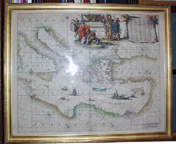
| Orientalior Districtus Maris Mediterannei. By Louis Renard. Amsterdam 1715. 59 x 48 cms. Engraved with full, period colour. Handsome and very rare Dutch sea chart of Eastern Mediterranean. Louis Renard first published Atlas de la Navigation, et du Commerce qui se fait dans toutes les parties du monde in 1715. The charts were printed from plates made by Frederick de Wit in 1675, Orbis Maritimus ofte Zee Atlas. These were corrected by Renard, using, primarily, van Keulen. Price: CyP 1400.00 | |
Pages 45 46 47 48 49 50 51 52 53 54 55 56 57 58 59 60 61 62 63 64 65 66 67 68 69 70