Price: CyP 1500.00
Maps. Cyprus. Page 89
|
|
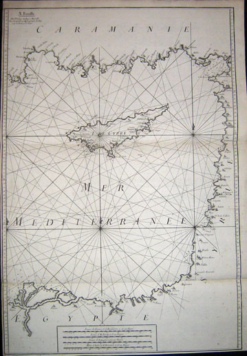
| I.De Cypre.X. Feuille. Avec Privilege du
Roy a Marseille. Chez Joseph Roux Hydrographe du Roy sur le Port a St.
Jean by Joseph Roux.
1764. First Edition.
Size 56 x 82 cms. Original copper engraving published in Roux's Atlas of
the Mediterranean. An excellent example. The coastlines and the Island
of Cyprus are decoratively engraved, many towns and villages are named,
as well as anchor places and the depth of the sea are marked. This large
size map, ever so popular and in stock again is in very good condition.
Narrow bottom margin, however this is the full sheet as published. Price: CyP 1500.00 |