Price: CyP 4,700.00
Maps. Cyprus. Page 107
|
|
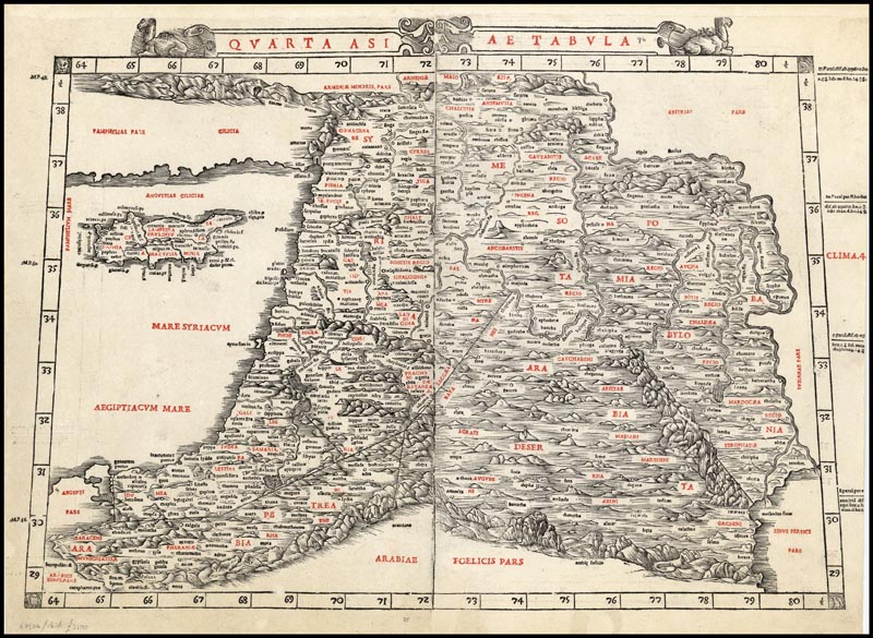
| Quarta Asiae Tabula [Holy Land
and Cyprus] by Bernadus Sylvanus.
Venice 1511. 56 x 38.5 cms.
Sylvanus' map of Cyprus, the Holy Land
and the regions west of the Tigris River is one of the earliest
obtainable maps of the region and the
first printed in two colors.
The map appeared in Sylvanus' Claudii Ptholemaei Alexandrini liber
Geographicae . . ., published in Venice in 1511. The Sylvanus edition of
Ptolemy is one of the earliest to include maps with modern geographical
updates. The map has been printed on
two leaves,
which have here been rejoined and backed with Japan paper on the verso,
with several minor
areas of loss skillfully repaired in California. A nice example of a map
that appears on the market once every blue moon. Great investment value. Price: CyP 4,700.00 |
Page 101 102 103 104 105 106 107 108 109 110 111 112 113 114 115 116 117 118 119 120 121 122 123 124 125 126 127 128 129 130