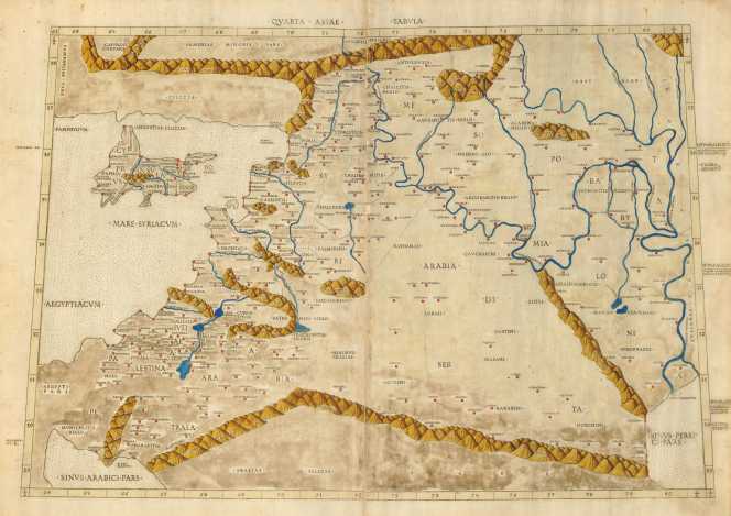
| This rare map from the 1507 Rome Ptolemy Geography is one of the legendary cartographic rarities. In 1507 and 1508, Bernardus Venetus de Vitalibus published editions of Ptolemy's Geography in Rome. It included not only the theretofore traditional 27 maps, but seven additional maps based on contemporary information. These are the first editions to include a world map showing the discoveries of the New World (by Johann Ruysch). With the exception of the Ruysch World Map sold for CyP 110,000 in 2001, no map from this atlas has appeared in a dealer catalogue since 1995. An essential map for collectors. |
Early colour with slight overall oxidation. There are a couple of areas
of small loss along the center joint, as in all maps that have been
printed in two sheets. Ref: Laor # 605; Mickwitz, Miekkavaara & Rantanen
(Nordenskiold) #202-25.
The earliest map currently in my stock.
Price: CyP 3,500.00